Places to go – Xepon Part 1

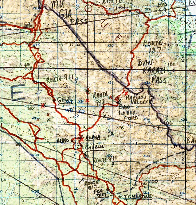
The town of Xepon appears in more after-action reports, CHECO, and Corona Harvest documentation about the war than any other place on the HCMT. So much went on at Xepon I’m dividing this into two or three parts. I’ll post the other parts in the next few days.

I discovered this song, Tchepone, on YouTube. The lyrics tell a lot about flying near Xepon and perhaps are a microcosm of the entire air war over the Ho CHi Minh Trail. Click on it and let it play as you continue on. (Click Here to read the LYRICS)

Xepon is another of the places Continue reading

Sidebar 7 – Operation Junction City, Jr.

Knife 61 and Knife 62 were shot down during Operation Junction City, Junior. (Don’t confuse this with the US Army 1967 “Operation Junction City.” The ’67 operation was named after the Kansas town, “Junction City.” Google it, and you’ll find lots of info.)

Perhaps the name for this operation (Junction City, Jr.) was well chosen because the goal was capturing the city at the junction of Ho Chi Minh Trail (HCMT) Routes 9 & 23. Route 9 came into Xepon from the east, and Route 23 was a main artery to the southern portion of the HCMT. The town was Muang Phin (also spelled Phine amongst others.)

Road Watch Teams (Operation Shining Brass/Prairie Fire) had unconfirmed reports of American prisoners Continue reading

Places to go – The Chokes

Our ride from the Ban Loboy Ford will go back down Route 912 to the junction with Route 911. This is where the two routes join with Route 91 leading to Tchepone (Xepon). The area of the junction was an obvious chokepoint for almost everything that made it through the Mu Gia and Ban Karai pass areas.

Although there were many natural “choke points” on the HCMT, this is the area pilots always called, “The Chokes.” It was “chokes”… plural… because there were several chokepoints in the area. Right at the R911 – R912 junction, there were three of the “chokes;” “Alpha,” “Bravo,” and “Charlie;” each one to designate a specific area near the junction.

Map of the main routes from the Mu Gia and Ban Karai passes going to Tchepone (Xepon)

Click on any of the pics in this post for a larger view. (They will open in another tab.)

The map above shows “The Chokes”. These were the key Continue reading